Drone surveys
Your house measured from the air, as a 3D model you can turn round on screen.
Builders and installers: we can survey a customer's house before you price. What you'd get ›
Opens an email. We reply with what you'd get and what it would cost, before anything is booked.
One roof survey, flown on Sunday 4 October 2026
Sizes read across that survey's whole 3D model were within about 3 cm. Another house's figures will be its own, so check any size on site before ordering or setting out. See that roof survey ›
What we do
A small camera drone circles the house and photographs it from every side and from above. The photographs become a measured 3D model: the walls, the roof slope by slope, the windows and doors, the chimney. A person checks what the computer reads before anything reaches you.
What it's for
House surveys
A measured 3D model of your house, with drawings of each wall and a plan of the roof.
For homeowners and buyers planning workProperty packs
Pictures from the air, a 3D model buyers can turn round, and how the sun crosses the garden.
For estate agents and sellersRoof inspections
Every slope seen from above: slipped or missing tiles, moss and worn joints, with photos of each.
For homeowners, landlords and roofers3D pictures
Your extension or solar panels drawn on the model of your own house, before anything is built.
For anyone planning workMeasured surveys
A 3D model and drawings of each wall, with sizes and heights read off it, for a designer, builder or solar installer to work from. Check any size on site before ordering or setting out.
For designers and tradesTaller buildings
Blocks of flats, churches and tall roofs. Each one is planned on its own, so ask first.
By arrangementAn example: a roof survey
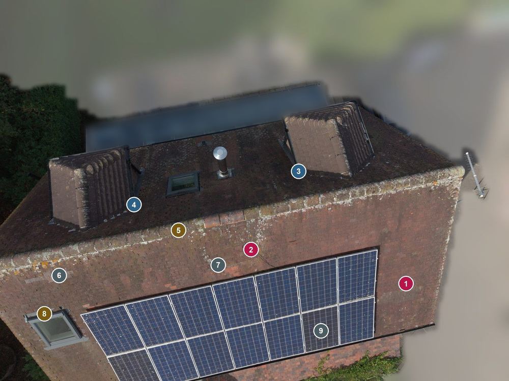
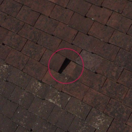
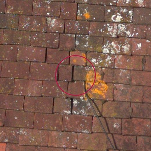
A tiled house roof with solar panels, flown on a Sunday afternoon and reported on the next day. We paid particular attention to some damaged tiles. No address is given, and everything that is not the house is blurred.
What we found:
- Two open gaps to fix before the winter: a small job for a roofer, usually one visit.
- The joins where the two dormers meet the main roof, to look at on the same visit.
- Worn mortar along the top of the roof, moss, and about 20 tiles from earlier repairs.
- Both slopes straight to within about 3 cm, with no sign of sagging.
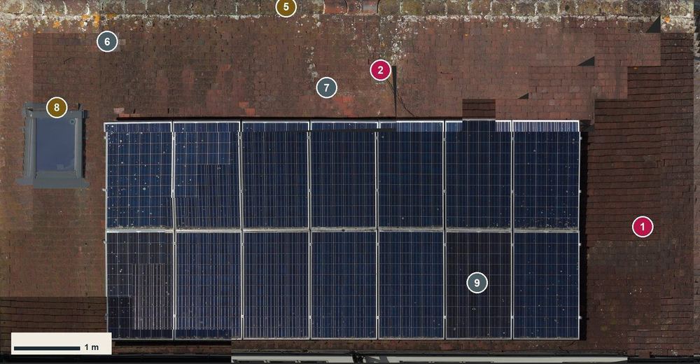
The report sees the roof from above only. It cannot see under the tiles, and a roofer may still need to look.
How it works
- Email us the town or postcode and what you want to know.
- We tell you whether it's a job for a drone, what you'd get and what it would cost, before anything is booked.
- We fly on a calm, dry day, usually in under an hour. Nobody needs to go up a ladder.
- You get the results: the model, the report or the pack. A house survey can open in Hopecraft to design on. Try the design tool on an example house › (an illustrative house, not the roof above: no flight took place for it, and the tool says so)
Straight answers
Is this a building survey or a valuation? No. It shows what the photographs show. It is not a RICS building survey, a valuation or a structural report.
Can a roof inspection see everything? No. It sees the roof from above. A leak can start where no camera can see, so a roofer may still need to look.
What about the neighbours? We photograph the property we're asked to, not the street. Anything of the neighbours' in a picture is blurred or cut out before it reaches you.
Where do you fly? Warwickshire and nearby. Some places are off limits to drones, such as near airports, so we check every site before we say yes.
What happens to the photos? The flight's own photos stay on our computer to make your results. We never publish them. More in our privacy notice.
Ask about a survey
Email Michael Hope at hopecraftuk@gmail.com with the town or postcode and what you'd like to know.